SHIPPING ON THE RIVER MEDWAY, THE SWALE, SHEERNESS, LONDON THAMESPORT AND LONDON GATEWAY
Welcome to the official website of Shipping on The River Medway, The Swale, Sheerness, London Thamesport and London Gateway.
The website will run alongside the Facebook page, which is all about the shipping movements in and around the River Medway, The Swale and Sheerness Docks, including London Thamesport and The Isle Of Grain and DP WORLDS LONDON GATEWAY.
The website will run alongside the Facebook page, which is all about the shipping movements in and around the River Medway, The Swale and Sheerness Docks, including London Thamesport and The Isle Of Grain and DP WORLDS LONDON GATEWAY.
The river at Rochester was the first major barrier to the Roman legions invading Britain, and they mounted their first camp controlling the river crossing.
The Medway was one of the favourite means of entry to Britain by the Danes who first appeared in the area in the 8th century.
The Normans fortified Rochester to control the Medway valley and greatly extended the use of the areas natural building material, Kentish ragstone. This was quarried around Maidstone and shifted by water down the Medway, up the Thames and around the coasts. It was also a centre for weaving and the Medway was a convenient way of smuggling wool out of the country when its export was strictly controlled.
The river became a ship building centre and supplied vessels to the Royal Navy from King Alfreds time. In 1547 a battery of guns was set up at Sheerness as a part of the defences of the new docklands at Woolwich and Deptford. Chatham Dockyard was established in 1547 with i20 shipwrights at work the first graving dock was built in 1581 and 400 feet of wharfage put down.
During the 17th century, bigger ships were finding it increasingly difficult to navigate the Medway and by the next century, sandbanks limited the sailing of big ships to the dockyard between half flood and half ebb.
In 1763, winds from only 6 points of the compass were suitable for taking down ships of the line and even then, only for a few days on Spring tides. Inevitably the authorities invested in dredging the river and in the 18th century nearly £2000 a year was being spent on cleansing the river.
This and the deep water anchorages near the mouth of the river led to the development of Sheerness.
In the middle of the 19th century a £3million extension of Chatham Dockyard took 33 years to complete. This trebled the size of the dockyard, and, Sheerness dockyard was built. From Elizabethan times, a good deal of naval building was also done in private yards. The Pilgrim Fathers Mayflower was launched at Strood, and from private yards came warships such as Bellerophon and Shannon which achieved fame during the Napoleonic Wars.
In the 17th century, important deposits of Fullers earth near Maidstone were being worked for the cloth industry. It was carried out of the Medway and up the east coast, as well as being smuggled out of the county from Gillingham.
Fishing has always been of great importance to the area. Oyster fisheries in particular enjoyed protection by ancient rights.
Paper making was established in the Maidstone area by the early 17th century, and rags for it were imported up the river until modem developments switched to wood pulp as its raw material. The Kemsley and Sittingbourne paper mills, now a part of the UK Paper Ltd group, were started in 1887. The river and its creeks provided the vast quantities of water needed for production as well as its transport system.
Gault Clay, found in the Medway area, became a prime source for the cement industry. Cement factories were started in the Frindsbury and Rochester area. Barges and coasters were at one time taking the products of seventeen cement works around the coasts of Britain. In this century the Isle of Grain near Sheerness has seen the building, and later dismantling, of a huge oil refinery, however its land has been developed into a large and successful container terminal and port, known as Thamesport.
BRIDGE REACH
Rochester Bridge
It is thought that the Romans built a bridge across the River Medway to carry their Watling Street, although no documentary evidence exists. The first recorded bridge is a wooden bridge built by the Saxons in 960. This bridge lasted until the late 14th century by which time it had fallen into a state of total disrepair. Realising the importance of the river crossing, two local Gentlemen, Sir John De Cobham and Sir Robert Knolles, built a stone bridge across the river here in 1387.
They were also responsible for the setting up of the Bridge Trust which still maintains the present Rochester Bridge. This is therefore the only privately owned bridge in the country to carry a major trunk road. The bridge of 1387 was replaced, in 1856, by an iron bridge designed by the engineer Cubitt. This bridge was completely rebuilt in 1914 in its present form. On the Esplanade, next to the offices of the Bridge Wardens, is the Bridge Chapel, built in 1392, and now used as the board room of the Bridge Wardens.
The Thames and Medway Canal
The Thames and Medway Canal was opened in October 1824. It was an attempt to reduce the passage time from the upper reaches of the Medway to London. The entrance can still be seen on the Frindsbury side of Bridge Reach at Rochester, although it is at present a disused railway tunnel.
The building of the canal took 25 years and involved the cutting of a two mile tunnel, the second largest in Britain at that time, between Higham and Frindsbury. Locks were constructed at each end of the canal. The tunnel was cut through Frindsbury Hill with a width of 27 feet, 22 feet for the canal and 5feet for the towpath. At the Medway end there was a large steam engine to supply the canal with water from the Medway on each tide. About £280.000 was spent in constructing these works, which at that time was considered one of the engineering wonders of the age.
The canal was not a success. It was generally used by Maidstone based craft, and unless a vessel/barge entered at a quarter tide it was unable to exit the other end until the next flood tide. During this time other barges were able to sail around the entrance of the Medway into the Thames, and therefore saved the canal charges. Difficulties were experienced owing to the steam boats which were used, washing down and destroying the banks.
The canal tunnel, being a financial failure, was converted into the Gravesend and Rochester Railway tunnel and was opened on 10th February 1845. The South Eastern Railway Company eventually bought out and took over the running of the tunnel in 1846. The canal was filled in and double railway track laid. Higham station now stands on the canal basin at the entrance to the tunnel. The Higham to Gravesend part of the canal was used by farmers to move agricultural produce and remained in use until 1935.
Strood Pier
The present Strood Pier is the second pier with that name. Both piers were built by the South Eastern Railway Company and were owned by it. A city ordnance quotes: No 76, The South eastern Railway Company, Liberty to extend a pier on the foreshore of the river at Frindsbury, granted llth May 1860, at an annual rent of 5s.
The pier was extensively used for mooring the local fishing smacks. A story goes that two fishing boats were owned separately by two brothers. The two brothers had married two sisters. Their families later consisted of one brother having eleven sons, the other having eleven daughters. Thus one of the fishing boats were renamed 'Eleven Brothers', the other 'Eleven Sisters'.
The original pier was situated further along Canal Road, just beyond the drain into the river. A few stumps of wood can still be seen close to the river bank, these being all that is left of that pier. The original Strood station of the Gravesend and Rochester Railway was built opposite the first pier, the terminus building being of wooden construction. The present station, now much modernised and resited, was built when the railway was extended to Maidstone.
LIMEHOUSE REACH
Lime works were a main feature of the Frindsbury area on the River Medway. The works were mainly situated close to the river. These works were largely converted to cement making in the mid 19th century. The proximity of these lime works gave Limehouse Reach its name.
The waterline on Frindsbury Ness was dominated by the many large chimneys from the kilns. By 1860 the firm of Messrs Lark Fletcher and Co was established at Strood Dock, Frindsbury. By 1865 there were eleven active cement works on the Medway, although several were up-river of Rochester Bridge.
Clay was dug from the marshes on the Medway. Many thousands of tons were removed from the Upchurch Marshes by barge to the cement works. The clay diggers beached their- barges on the saltings on a falling tide, loaded at low water with a special spade known as a Fly Tool, and floated off at high water. The clay digging took place on such a scale as to concern the Rochester Corporation, and later the Medway Conservancy Board and the Admiralty. The biggest mud contractor on the Medway at the turn of the century was S. J. Brice and Sons of the Point Barge Yard. Between 1881 and 1911 he dug 1,356,000 tons from East Hoo Creek and between 1881 and 1907, 557,000 tons from West Hoo Creek as well as being active in other areas of the river.
All the cement works on the Medway were situated with their own wharves on the riverside. Most cement companies operated their own barges which helped the barge builders of the Medway area.
This is generally the commercial centre of the river at Rochester. Crown Wharfs on the port side and Limehouse or Honigs wharfs on the starboard side are the main wharfs used for the importing of timber, and paper pulp. The cement works on the port side have long since disappeared and many of the numerous buoys which littered the reach have been lifted.
The reach extends to Sun Pier, from which a marvellous view of Chatham Reach as far as Upnor can be seen.
Furrels Creek
Furrels Creek is at the end of Furrels Lane off Chatham High Street. A viaduct crosses the end of the lane and the Rail Freight Depot, known as 'Chatham Goods', is opposite the creek. Furrels Lane is named after Frederick Furrel who was Mayor of Rochester in 1855. Somewhere near the creek was a wharf also named after the mayor. From this wharf Mr. Furrel and his son operated a coal merchants. In the days of open coal fires every other wharf was a coal wharf! Today Furrels Creek, like Blue Boar Creek, is nothing more than a storm water outfall. At the turn of the century the creek extended under the railway and almost to the High Street.
The present car show rooms at the head of Furrels Lane were once the Mission to Seaman Institute.
Boundary -wharf and Kettle Hard.
As you drive towards the Pentagon shopping centre from Rochester, the boundary sign for Chatham is passed on the left. Immediately into Chatham and next to the boundary sign is the Sir John Hawkins Hospital. This was originally built in 1592 but was re-built in 1722. The hospital was given a £200,000 facelift in 1983-84 when the two story cottages were converted almshouses of ten flats. These were for the use of "decayed and retired mariners" of Chatham. The re-opening ceremony was performed by HM the Queen Mother in April 1984. On the river front, the boundary between Rochester and Chatham is marked by Boundary Wharf; or to give it its full title. City Boundary Wharf. The wharf is still there, behind what was Featherstones Department Store. The annual rent for this wharf in 1861 was ls4d.
Next to Boundary wharf is Kettle Hard. This mud beach was used by the Chatham Medway fishermen to repair and tend their nets. The name apparently comes from the Kettle nets used to trap the fish. Nets were strung between a series of poles set into the soft shingle. On the Chatham side of the hard is the remains of the Old Mid Kent Wharf and London Wharf. Whilst most of the wharves in this area were coal wharves, the London Wharf was a brewery wharf. There was another brewery wharf adjacent to London wharf which belonged to the Black Eagle brewery of Spitalfields. They had their own sailing barge which made twice weekly trips to Chatham with beer.
Chatham Intra
"Into Rochester or Chatham ..... Because if anybody knows to a nicety where Rochester ends and Chatham begins is more than I do".
This statement by Charles Dickens in his book "Seven Poor Travellers" covers an area of no mans land between Chatham and Rochester known as "Chatham Intra". People living in this area, usually riverfolk, paid rates to either Rochester or Chatham. It has no parish church and so church allegiances were divided between St. Marys Church, Chatham or St Nicholas's Church, Rochester.
Ship Pier and Doust's Yard both belonged to this area. Doust's Yard was originally owned by William George Gill, who’s once grand residence has a slipway in front of it, known as Gills Lower Yard. Many barges and yachts were built at this yard including several paddle steamers. The company also owned a site in Bridge Reach, known as the upper Yard. Gill's became the founders of the London and Rochester Trading Company, whose barges were a common feature on the River Medway. Another slipway was built next to Gill's and became Doust's Yard. This company operated from Old Foundry Wharf and remained in Rochester for over fifty years until it closed in the 1980's. Old Foundry Wharf was also occupied by Wm. Kimmins, cornfactor, and S. Bullard, sail maker and brewers agent.
Old Foundry Wharf buildings are still in position however, in the aid of progress, the buildings of Dousts Yard have been demolished recently to make way for a car park.
Chatham Reach.
CHATHAM REACH
The Gunwharf, Rochester
The Gunwharf now consists of a low green with various types of ordanance along the river wall. It has the modem "Lloyds Building" as its backdrop.
This building replaces a group of long red-bricked buildings. The Gunwharf formed a temporary barracks for some of Cromwell's troops during the Civil War. It is a local tradition that passages run under the river to the rising ground on the opposite bank of the Medway.
On the starboard bank now comes the long red brick buildings of the Ropery in the Historical Dockyard . These two buildings house rope spinning machinery which still provide rope for the Royal Navy. The rope making was mechanised in 1811, and one of the original forming machines remains in regular use. The Ropewalk is 1128 ft long, to make a 120 fathom (220m) rope.
The Historical Dockyard is on an 80 acre site of the former Royal Navy Chatham Dockyard which dosed in 1984.
Chatham Dockyard
The Chatham Dockyard was founded in 1547 as a ship repair yard. It soon became a shipbuilding centre, the first building being the Sunne in 1586. Many of the English ships that took part in the battle off Gravelines against the Spanish Armada in 1588 sailed from Chatham. The site of the original dockyard was only a few acres in size and stood further up the river nearer the town centre. It moved to its present situation in the seventeenth century where it had greater facilities including docks, cranes and workshops.
Notable ships built at Chatham were the Victory (1765), Queen Charlotte (1790)-the flagship of Lord Howe at the Glorious First of June and Achilles (1863)-the first iron battleship.
Due to the limitations of size of vessel that could be built, shipbuilding from the turn of the century concentrated on submarines. Between 1908 and 1966 fifty seven were launched, the final vessel being HMCS Okanagan for the Royal Canadian Navy in 1966.
Thunderbolt Pier
This floating pier is actually the floating battery 'Thunderbolt". It was built at the Thames ironworks in 1856 for service in the Crimean War. With her sisters ‘Erebus' and ‘Terror’ she was the first armoured iron-built warship constructed for the Royal Navy. The war, however, ended before she was brought into service.
Upnor Castle
Upnor Castle was built by order of Queen Elizabeth I to protect her warships anchored off the Chatham Dockyards in the River Medway. Building was started in 1559, the year after the Queens succession, and the castle commissioned in 1567. The stone used was from the outer walls of Rochester Castle.
William Boume, while Master Gunner at Upnor had prepared a memorandum on protecting the Navy.
It's view was that large guns were insufficient to repel invading vessels. They may be demasted or damaged but not sunk. He proposed that a chain be drawn across the Medway. This was implemented in 1585 during the war with Spain. The maintenance of the chain was costing £80 per annum in 1588. At this time there were 6 gunners and 1 Master Gunner. Later, in 1596, Upnor Castle appears to have been inadequately manned. Lord Admiral Howard reported that the castle should be well garrisoned or pulled down. Its garrison was subsequently increased to 80.
In the early 17th century additions to the castle included the stone parapet on the seaward side, this in turn had a palisade to seaward to prevent invading vessels approaching too close to the castle. The timbers of the original palisade can still be seen at low water just inside the present palisade.
A ditch was dug around the outer landward walls of the castle, this being 32ft wide and 18ft deep when completed. Sheep were allowed to graze in this ditch and thereby prevent any handholds being accessible to any invader.
The Civil War.
At the outbreak of the Civil War in 1642, Upnor Castle was surrendered to the Parliamentary forces and was garrisoned by them, serving as a prison for Royalist officers. In the sudden rising in Kent of Royalist sympathizers the castle was captured in 1648. This insurrection was soon suppressed and the governor. Major Brown, returned to his post a visit by the parliamentary general, Fairfax, led to repairs and improvements being undertaken.
The Dutch raid of 1667
Upnor Castle saw action at the end of the Second Dutch war (1665 - 1667). In July 1667 the Royal Navy won a victory over the Dutch at the Battle of Orfordness (or North Foreland). In order to save money following this victory the government decided to lay up the fleet and rely on coastal defences for protection. A Dutch squadron under Admiral De Ruyter sailed to the Thames estuary in 1667. After reaching Gravesend he altered for the Medway.
10th June - 800 Dutch sea soldiers sacked and burned the uncompleted fort at Sheerness.
11th June - The chain was in position across the river between Hoo Ness and Gillingham. Gun batteries were constructed at each end of the chain. An extra gun battery was built next to Upnor Castle.
12th June - The Dutch bore down on the chain. Whether it was loosed by a landing party or it just parted is unknown, however it was no obstacle. Guided by defecting soldiers who had a grievance over pay and conditions at Upnor the squadron approached Upnor Castle.
13th June - The Dutch fleet reached Upnor Castle and met with fierce fire. There were many casualties on both sides including the loss of several English warships.
The Dutch anchored while the tide turned before resuming the fight. The garrison was eventually silenced by lack of ammunition but not overrun. More shipping was burnt but the Dutch fleet could not progress and eventually retired to Queenborough on 14th June where they remained for several days before returning to sea.
Following this raid it was proposed to reinstate the chain as a defence, however it was turned down in favour of more forts. These being built at Cockham Wood and Gillingham. There are still traces of the Cockham Wood fort but the Gillingham one has been built over.
Fortress to Magazine
In 1668 it was ordered that Upnor Castle should be converted to a "Place of Stores and Magazine." At this time various changes were made to the buildings until in 1698 the Castle looked very much as it does today.
A garrison was still kept at Upnor which was full of minor events but major issues passed them by. When a warship arrived at the Blackstakes in the Lower Medway Officers from Chatham boarded and supervised the removal of the gunpowder. This was then transported to Upnor Castle where it was sifted, coopered and then put in the magazine. Its condition was then reported to the Ordnance Board. Upnor was at one time the premier store of gunpowder in England, even over the Tower of London, it supplied all the warships which anchored in the Nore or off Queenborough.
in 1695, 9in square posts had to be positioned in the main store to support the weight from the first floor store. In the powder rooms all the doors and windows are copper sheathed. The hand rails to the stairs were lined with lead. The ground floor was made of 9in square oak heart beams being wedged upright into the sandy base. In this case nails were not required. Other precautions to prevent fires were that all personnel had to wear leather boots made with hard leather nails to prevent sparks.
Later history
After 1827 Upnor ceased to be a magazine and was fitted as an Ordnance laboratory. By 1840 there were no stocks of gunpowder or explosives. In 1891 it was transferred from the War Office to the Admiralty. It was used more and more as a store, however by 1945 it was now recognised as a museum. Since 1961, after restoration, the castle has been maintained as a national monument
A famous Hospital Ship in the Medway
In 1828 the Medway area's first purpose built naval infirmary was opened. This was the Melville Hospital, named after Lord Melville the First Lord of the Admiralty, 1812 - 1827 and 1828-30. It was sited on land immediately opposite the Main Gate to the Chatham Dockyard.
Prior to its opening, rather than designating a building to act as a hospital, a number of old warships were used under the auspices of the Sick and Wounded Board, the body responsible for the care of those injured in naval service.
These old and battered ships were cold, damp and generally overcrowded.
The vessels themselves were one stop away from being broken up. One notable exception was the Victory, Nelsons flagship at the Battle of Trafalgar. Victory was temporarily struck off the active list in October 1797 and was moved into the Medway in December of that year. She was then allocated to the Sick and Wounded Board until January 1799. A shortage of three decker warships led to her reprieve.
She was taken to the dockyard at Chatham for reconstruction. In 1805 she was able to lead the British fleet in its attack upon the combined French and Spanish fleets.
Arethusa
On the port side is the Arethusa Venture Centre.
This centre caters for youth activities including water sports, swimming and field sports. At the head of a causeway is the figurehead of the old Arethusa a 50 gun frigate built at Pembroke in 1849. Until recently the training vessel Arethusa was moored off the causeway.
She was formerly the 'Peking a nitrate carrier of the Laeisz Line of Hamburg. The latest Arethusa is a two masted yacht, but still used as a training vessel.
The Pekin
The PEKING was launched on the 25th of February 1911 at the Blohm & Voss shipyard on the River Elbe at Hamburg. She was delivered to her owners, Rederie F. Laiesz, on the 16th of May 1911.
She sailed on her companies Chilean/European service until 1919 when she was given to Italy in war reparations. Laiesz got her back soon afterwards and in 1926 they fitted her out as a cargo training ship with accommodation for cadets as well as the crew, bringing her compliment up to about 74.
In 1932 due to various factors she was put up for sale and purchased by the Shaftsbury Homes and Arethusa Ship Training Society. She was to replace the old wooden man of war ARETHUSA which had become beyond economical repair. The new ARETHUSA was moored at Upnor in the River Medway as the original berth at Greenhithe was becoming unsuitable due to increasing river traffic. It is curious to see that the CUTTY SARK and HMS WORCESTER managed to remain at Greenhithe until well after the war.
The PEKING was reputedly in good condition but Gustav Erikson turned down making an offer for her in 1932 on the recommendation of one of his senior Masters. Rumour has it that she had been overstressed in her short life with F. Laiesz. The PEKING lay at Upnor for the Shaftsbury Homes until 1975. She spent a while in Chatham Dockyard as an accommodation ship for engineering Petty Officers and was temporarily renamed HMS PEKIN.
In 1974 it was obvious her upkeep was going to be too expensive, she had already been derigged to a sort of barquentine, and Shaftsbury Homes decided to sell the ship and move the school ashore. Some local groups tried to raise funds to keep her in the Medway but were defeated by disinterest and chauvinistic statements like "she was not a British ship". The fact that she had been in the Medway for 43 years and had trained countless numbers of British boys obviously counted for nothing.
She was bought at public auction by the J. Aron Charitable Foundation of New York for the South Street Seaport Museum for £70,000.
Rounding St Mary's Island, Gillingham Marina lies ahead with the Bullnose on the starboard side. The Bullnose marks the entrance into the enclosed docks of the now commercial docks at Chatham. This was the former Royal Navy dock.
The bullnose is marked by a signal station and has two lock entrances into the docks. Emergency destroyers used to lie off the bullnose, usually two or three, of which one had to maintain steam in order to proceed to sea at once if required.
A 'trot boat' was used from Gillingham Pier to keep communication with the destroyers and the shore.
It is from the Bullnose that the annual Medway Barges Race is held.
Jezreels Tower
The skyline of Gillingham was, until 1961, disrupted by the square, box like form of The Temple of the Latter House of Israel, or Jezreels Tower. This was a monument to a strange sect which began to build a tower during the last century to act as an Ark for its members at the final deluge. It was a prominent landmark and used as an aid to navigation, lines of bearings from the tower appearing on the Admiralty charts.
The river up to this point has been bordered by yacht trots which in the summer months are full of many types of medium and small sized yachts
Below Gillingham Pier, the river leaves the Medway Town conurbations and is flanked by extensive marshes, saltings and mud flats. Most of these areas have been designated Areas of Special Scientific Interest. They provide havens for the varied species of migratory birds.
Below Gillingham Pier, the river leaves the Medway Town conurbations and is flanked by extensive marshes, saltings and mud flats. Most of these areas have been designated Areas of Special Scientific Interest. They provide havens for the varied species of migratory birds.
Gillingham Piers and Gillingham Fort. The original pier at Gillingham was built some way westwards of the present pier. The entrance to it is still marked by the Bridge House along Medway Road, now one of the entrances to Chatham Maritime. To former dockyard employees it was known as Gulingham Gate. The old pier, known as Bridge Wharf and Collier Dock were engulfed into the Royal Dockyard extension in the middle of the last century.
The new pier was opened on 13th February 1873 at a cost of £330,000. A metal extension known as Admiralty Pier was added later. It was from Admiralty Pier that the local trot boat served the Royal Navy ships at anchor in the river off Chatham, hence its name.
Gillingham Fort or Castle was completed in 1669 and was sited to the north east of the present Gillingham Pier. At the time of the Dutch invasion in 1667 it had only four guns capable of being brought to bear. The fort was demolished in the 19th century.
Copperhouse Marshes
These were so named after the Copperas works at Gillingham. Copperas was used as a dye for woollen cloth and for tanning. It was made by steeping iron pyrites in wooden vats for about six years and then boiling off the liquid. After evaporation the crystals of the dye were formed. There were Copperas factories in Queenborough in the 16th century and at Whitstable.
Burntwick, Slayhills and Barksore Marshes
These were once far more extensive than they are at present. In the nineteenth century much of the marsh clay was removed for cement manufacture. Over the successive years the present winding waterways were formed.
Sharps Green and Horrid Hill.
Part of the Riverside Country Park at Rainham is made up of a causeway which runs to a low mound called Horrid Hill. Convicts housed on the hulks in the Medway anchored close to Chatham attempted to escape to the hump of land that looked like an island. Those that were recaptured were hanged as a warning to others, hence the name "Horrid Hill". Horrid Hill marks the end of Sharps Green, which proved an ideal place for smugglers.
The last inhabitants of Sharps Green was the smallest cement works on record. The Sharps Green Cement Works was erected in 1902 using second hand equipment, it was the last to use static chamber kilns. Chalk was dug at the Tyndal Quarry and transported to Horrid Hill by wagon. The Cement works closed in 1913, the last vessel to berth there being a barge, the "Dick Turpin". This barge had the unfortunate experience of going aground in the bay off Horrid Hill in 1913, some of its cargo of Dundee marmalade jars can still be recovered.
'Gryping* - the searching of water ditches and trenches in the marsh area for Flounder
Motney Hill
When thinking of Motney Hill, or Motley as it was occasionally known, one thinks of sewerage. Maps dated in 1819 show it as an island originally famous for its sand and known also as "Gritty Island".
The Motney Hill sewerage installations and pumping station were in place by 1923. The pumping station building resembling a village school. It processed the waste from Rochester and Chatham but included Gillingham later. Rainham at that time was not on main drainage as the village was officially a part of Milton, near Sittingbourne.
Amid many protests, Rainham became part of Gillingham in 1928. This made it possible for Rainham to be put on main drainage. Had Motney Hill, just a small spur of land, not been developed as a waste treatment works then Rainham would probably become a town in its own right. Rainham had been connected to Gillingham by bus and train routes before 1928, but there were no other ties whatsoever. Many local residents refuse to acknowledge Gillingham as part of the Rainham address.
The works have been modernised over the years and now handles over 10 million gallons of effluent each day.
The road to Motney Hill starts on the lower road, next to the only shop in Lower Rainham "Hills Stores".
The Palmerston 'Folly' Forts
Following French invasion scares in the 1840's and early 1850's, a Royal Commission on the Defence of the United Kingdom was set up.
After its 1859 report, worried by the inadequacy of the existing defences against the new steam warships and rifled guns (vastly more powerful than the old smooth bored guns), the most expensive national scheme of coastal defences was started. In the 1860 Royal Commission for the defence of the United Kingdom, one of the recommendations for the Medway was for the provision of two powerful gun batteries on the islands of Burntwick and Oakham; replacing the earlier 18th century battery on the latter. A boom was also to be established between them.
On survey the ground for the proposed sites was found to be unsuitable to carry the weight of the forts and guns, so the positioning of the forts was altered to Hoo Ness and Darnet Ness.
Originally it was intended that each fort should mount 25 rifled muzzle-loading guns on two tiers protected by heavy iron shields set in granite blocks. During construction it was obvious that the marshy ground could not stand such weight, each gun was to weigh seven tons. In 1867 the forts were modified to one tier and the armament reduced to eleven 9" guns at Hoo Fort, and nine 9" guns and three 7" guns at Darnet.
The general plan of the fort is round with an open courtyard in the centre at the level of the first floor, out of which were the eleven casements for housing the guns. Directly below these were the stores and accommodation on the ground floor.
There were ammunition lift shafts and voice-pipe communications between the emplacements and the subterranean magazines. This represented quite an advance in industrial technology.
The forts were completed and operational by 1872 and remained in the care of a Master Gunner until the First World War when they were disarmed and abandoned by the arm. Today both forts are in good condition but Hoo Fort is still on MOD property and entry is barred to the public. Garrison Point Fort is also an example of these forts, where the rear of the gun casements can be clearly seen from the lift entrance to the Navigation Tower.
Long Reach
On entering into Long Reach, the Kingsnorth Power Station is passed on the north side of the river, its tall chimney providing a local prominent landmark.
A First World War base for the Royal flying Corps and, later, an airship base at Kingsnorth was taken over in 1930 by Berry Wiggins and Company Ltd. as an oil refinery.
Later, another jetty was built at Bee Ness in Kethole Reach capable of taking tankers up to 13,000 tons. This is now derelict.
The company's original jetty was supplemented by one at Oakhamness, and is still in use for the Central Electricity Generating Board, (now Powergen).
Kethole Reach
Rounding Oakhamness into Kethole Reach the river opens out a little more. On the port hand are two buoys marking a wreck.
HMS Bulwark- It was here that on 27th November 1914, HMS Bulwark blew up, suddenly and mysteriously, with heavy loss of life. Bulwark was a 'London' class battleship, built at Devonport in 1899 but her home port was Portsmouth. Since 1912 she had been stationed with the 'Nore Division' at Sheerness. The cause of the explosion was never established, but an inquiry ruled out any the possibility of foreign attack.
Sabotage was similarly ruled out, although when four similar disasters occurred on board navy ships this theory gained popularity.
SALTPAN REACH
Salt-panning took place in the River Medway between the reign of Elizabeth 1st and the 1700's. There are two sites on the Isle of Grain and other workings on the Isle of Sheppey. The works received brine from the Medway and the necessary timber from the Weald or coal from Tyneside.
Leaden cysterns were used until coal was substituted as the heating fuel, when iron boiling pans were used. These salt works were comparatively small. Four men were employed per boiling pan, thus the Isle of Grain works employed about 40 men.
A second salt works was erected on the Isle of Grain about one mile from the Thames on the North Yantlet Creek sometime before 1750.
The production of salt on the Isle of Grain ended probably in the first decade of the 19th century. The pans appear on maps of 1805, although only the North Yantlet ones appear on a map of 1810. The Grain pans suffered as a result of competition of rock salt discovered in Cheshire in 1670. Many sea salt pans had collapsed by the 1750s due to the coal requirement of only one ton to produce one ton of rock salt compared to 6 tons to produce one ton of sea salt.
The salt industry was encouraged in an effort to reduce the amount of salt being imported from Spain and France, since England during this time was almost permanently in conflict with them. Salt was an essential commodity for the preservation of fish and meat. The Medway saltings had plenty of shallow briney water with a local supply of timber. The necessary coal was shipped from the north-east of England.
The salt pans lasted until the early 1700's when Cheshire rock salt took over the trade. Saltpan Reach is so named after this local salt trade.
On the port side, what was once a large oil refinery is now a busy container port. Few of the many original oil storage tanks remain. To starboard is Stangate Creek. It was in this area that the gunboat 'Bustard' on passage from Sheerness to Chatham during the great frost of 1895, found ice so thick that she was forced to drop her anchor onto the floes.
Deadmans Island
During the Napoleonic Wars the French prisoners of war were housed in hulks on the Medway. In such confined quarters cholera, smallpox and typhoid were rife. Those who succumbed were buried on Deadmans Island and Prisoners Bank. The hulks were scrapped after the building of St. Marys prison at Chatham in 1856. Many of the hulk timbers were used in houses built in that era at Gillingham and Chatham.
Port Victoria
Until 1953, the Isle of Grain was essentially a sheep marsh. A railway line and pier had been built but there was no development. British Petroleum Ltd. decided on the Isle of Grain for its Kent terminal and refinery, and it began processing its first crude oil in 1953 at the rate of about 41/2 million tons a year. Later, over 11 million tons a year were processed.
Nine main jetties and three coaster jetties were built to handle the shipping. This development transformed the total activities of the River Medway. For its cooling requirement the refinery drew some five million gallons of salt water each hour from the river. By enclosing a small bay, a sixteen million gallon reservoir was created which normally filled automatically each tide.
After circulating through the plant, the cooling water passed through separators before being discharged back into the river. Thus any oil present was skimmed off the surface and returned to the refinery for processing. This large complex was closed when it was decided to develop the northern refinery at Scapa Row in the Orkneys. This refinery was closer to the North Sea oil fields
Thamesport
After the demolition of the oil refinery, the land was a prime site for development. Thamesport (London) Limited moved in with plans for a deep sea container terminal. The first stage of development was built from scratch in 18 months and within eight months of starting operation was handling cargo at a rate of 100,000 containers per annum.
Princess Irene
One of these disasters (after HMS Bulwark) occurred to the Princess Irene, a fast minelayer converted from a three funnel passenger liner. She blew up in Saltpan reach, just six months after the Bulwark tragedy.
She was loaded with mines and the explosion was greater than that of the Bulwark. Windows were broken in Sittingbourne and charred paper from the vessel landed in Maidstone.
Once again the findings of the enquiry were inconclusive, although inexperienced handling of the explosives was suspected. The wreck of the Princess Irene is now marked by an IALA danger buoy.
The Royal Dockyard, Sheerness
The Royal Dockyard was founded by King Charles II during the mid seventeenth century. It was ideally placed for servicing vessels in the Nore anchorage.
Before the dockyard was completed, the Dutch launched a raid by Admiral van Ghent during which a fort designed to protect the dockyard was completely dismantled. The Dutch fleet then sailed further into the Medway.
During the wars with Revolutionary France, Sheerness was particularly busy. The main work at Sheerness was the repair of warships, however a number of vessels were built.
The dockyard was modernised in the nineteenth century. This included the building of a wet dock, or great basin, three new dry-docks and many new buildings.
A sunset ceremony was held on 31st March 1960 to mark the closure of the Royal Navy Dockyard. On 11th April 1960 the Sheerness Harbour Company Ltd was incorporated to make a small commercial port. This "small commercial port has now grown into the thriving port of Sheerness of today and is owned by Port of Sheerness Ltd.
The Worm
One problem suffered by the early wooden warships using Sheerness was the teredo navalis worm. This worm was normally associated with tropical waters and it was thought that vessels quarantining in Stangate Creek introduced it to the area.
This worm bored into the timber hulls and reduced the strength. The problem was eventually overcome when copper bottomed hulls were introduced on vessels.
It was the problem with the worm that prevented the expansion of Sheerness during the eighteenth century.
Sheerness
With the rise in importance of the dockyard at Chatham it was decided that Henry VIII’s protecting fort at Sheerness was outdated. This was, at the time, the only building at Sheerness, Sheerness being a point of marshland protruding into the River Medway at the north west part of the Isle of Sheppey.
In 1666, the new fort was designed and the building commenced. The fort was completely demolished in 1667 during the Dutch raid of the Medway. By 1672, a piece of land was enclosed with a store house in place.
The workmen working on the dockyards were allowed to take lengths of timber called "chips". These were to be not longer than three feet long and be capable of being carried on one shoulder. These were used to build makeshift houses adjacent to the dockyard area. These cabins were then painted with grey-blue naval paint giving rise to the local name of Blue Houses. This was later corrupted to "Blue Town", and now as "Bluetown".
While the Blue Houses provided accommodation for some of the dockyard workers, by far the majority were housed in hulks of old warships positioned to break the flow of tide in the river. This reduced the loss of shingle from the foreshore.
Conditions were very primitive and thieving commonplace. Men could not be persuaded to come to work at Sheerness and despite the reopening of a well at Queenborough, (on the site of the present steel works), there was a water shortage.
The yard grew slowly, the first dry-dock was built in 1708. An extension to the dockyard were proposed in 1765 but malaria, lack of water and sanitation caused it to be shelved.
In the 1820's a serious fire destroyed many buildings at the dockyard including all the remaining cabins made from "chips". This lead to a major rebuilding programme being undertaken. The new houses became part of the development of Sheerness. In 1827 the dockyard was enclosed by a high brick wall. Convicts from the hulks provided much of the labour.
A moat was dug outside the garrison and dockyard as a defence measure, a drawbridge being the entrance. This was in place until the end of the century. The town extended away from the dockyard and Mile Town came into existence. This was a series of courts and alleys.
Sheerness was not granted the status of town until the end of the 19th century, until that time it had been a part of Minster parish. Conditions improved, mains water being installed in 1863, although it was provided by standpipes in each street, only the wealthy residents being able to afford to have it supplied direct. Bluetown had a particularly unsavoury reputation. Theft, drunkenness and fights were common. It was claimed that every other building was a pub and every third one a brothel. The railway came to the island in 1863, the first station being built in the Dockyard.
The housing in Bluetown was rebuilt several times, however in the late 1950's and early 1960's all the wooden houses were demolished and none of the older houses of Blue Town remained. With the demise of the dockyard in 1960 most of the houses, pubs and shops disappeared and although the name Blue Town is still used; it is largely an industrial area dominated by the Steel Works and Sheerness port.
The Sheerness Boat Store
Completed in 1860, the Sheerness Boat Store was the world's first multi storey building with a rigid portal frame and so was the direct forerunner of the modem skyscraper.
It is the first surviving example of a multi-story building having a complete iron framework. The structure of the store is of cast iron columns, four metres off the ground which support seven metre long cast iron beams. All have an I or H shaped cross-section and brackets support the points where they interlock, forming a completely rigid iron frame. This contrasts with the more elaborate and decorated forms of the period.
Grain Tower
Grain Tower is situated where the Thames and Medway meet. It was generally constructed in the latter half of the 17th century. It is often mistaken as a Martello Tower, although these only appeared at a later date.
The tower was built to co-ordinate fire with the Sheerness Batteries to block the River Medway and to oppose any landing on the Isle of Grain. The armament was three 24 pounders.
In 1859 the Royal Commission for the Defence of the United Kingdom recommended that it be rebuilt as a stronger casement work; however expense precluded this. The tower retained its three smooth bore guns until it became a signal station early this century. During the period up to the Second World War and throughout the War the exterior of the fort was greatly changed by brick additions to the main structure. During the Second World War a six-pounder anti-aircraft gun was mounted on the roof of the tower.
Today the tower can be reached at low water by a causeway and it remains as it was left at the end of the Second World War. The original tower was constructed with Portland Stone and is easily distinguished from the later brick additions.
The first lightship to be moored in English waters was fitted out in 1731 by Robert Hamblin for the Nore Sands. It was known as the Nore Light.
QUEENBOROUGH
Flushing Pier
During the early 1870's, the Dutch government was looking for a quicker and more convenient route for mail and passengers than the Harwich to Rotterdam route. At this time the Continental Traffic Agreement was in place. This regulated the pooling of revenue, in various percentages, arising from Kent Coast to the Continent services to the several companies involved in this traffic. Kent Coast in this agreement referred to all ports between Margate and Hastings.
The London, Chatham and Dover Railway had a railway line in operation between Sittingbourne and Sheerness which commenced on 19th July 1860. They successfully tendered for the new mail and passenger contract and decided to use Queenborough as a continental port, Queenborough being outside the Continental Traffic Agreement. Queenborough Pier was to provide a rail link to the existing local line joining it between Queenborough and Sheerness.
The Zeeland Steamship company was formed when agreements between the Dutch Railways and the London, Chatham and Dover Railway were signed for the conveying of passengers, mails, and freight via Queenborough and flushing.
The rail link between Queenborough and the pier opened on, 15th May 1876, although the Zeeland Steamship Company had commenced its service the previous year using Sheerness Pier until Queenborough Pier was opened. The Queenborough to Flushing service soon became known as the Flushing Ferry. Queenborough Pier was of a “ T ” construction and extended sufficiently far into the Swale that the paddle steamers could use it at any state of tide. The railway station platform ran the length of the pier and cranes at the head of the pier handled the freight and luggage.
Queenborough Pier was damaged by fire on 18th May 1882 and the Flushing service was temporarily operated from Dover. A serious fire on 9th July 1900 extensively damaged the pier and services from the pier were not possible until the following January. In the mean time the passenger service was operated from Port Victoria, (Isle of Grain). Freight was diverted via Tilbury.
The pier was almost completely rebuilt over the next four years. A rival railway company. The South Eastern Railway, had hoped to attract the passenger ferry to its deep water berths at Port Victoria. This did not materialise and the rail companies eventually amalgamated. The S.E.R. provided a ferry service from Port Victoria to Queenborough Pier but this was not well used and withdrawn in 1901.
Soon after amalgamation, in 1899, the Dutch mails were transferred to the Harwich - Hook route when the Great Eastern Railway undertook to provide suitable turbine powered vessels.
A further blow to the service occurred when the night sailings were transferred to Folkestone, the new larger Zeeland ferry’s being unsuitable for navigation in the Medway. The day sailings continued from Queenborough Pier until the outbreak of the First World War.
The Flushing route reopened in 1919 but used Folkestone as the terminal. This was superseded by Parkestone Quay, Harwich in 1926.
Queenborough Pier remained open as a cargo berth, but Queenborough lost its status as a continental passenger port. Cargo to the pier gradually declined until it was almost disused by 1933. During the Second World War administration of the pier passed to the Admiralty.
From this period onward the pier was disused and the structure progressively decayed. The end eventually came in 1955 when its demolition commenced. At low water the stumps of the pier supports are all that remain to be seen. The rail lines are still in place and used as a sidings for freight.
S.S. RICHARD MONTGOMERY
Length overall : 441 ft 6 in
Length (BP) : 417ft Bin
Length (waterline) : 427 ft
Breadth (extreme) : 57 ft
Breadth (moulded) : 56 ft 10 in
Depth (moulded) : 37 ft 4 in
Freeboard : 9 ft 8 in
Tons (Registered) : 7176 Gross. 4380 Net
Tons (Deadweight) : 10.865
Tons (Displacement) : 14.245
Main engine : direct acting, condensing, three cylinder triple expansion.
2500 HP at 76 RPM.
Speed : 11 knots
The Stranding
After taking on bombs and munitions at Hog Island, Philadelphia, the Richard Montgomery sailed from the Delaware River to the Thames Estuary, to await a convoy for Cherbourg.
On arrival off Southend, she came under the authority of the Thames Naval Control at HMS Leigh, which was, in fact. Southend Pier. The King's Harbour Master, who controlled the shipping movements and anchorages in the estuary, ordered her to anchor off the north end of the Sheerness Middle Sand in about 33 ft of water at low tide.
The anchorage was not the most suitable for a vessel of her size, particularly since she was trimmed to a draft of 31 ft aft, over 3 ft more than usual for a 'Liberty’ ship.
Richard Montgomery grounded on Sunday, 20th August 1944 when the wind went northerly.
She was stranded on top of the Sheerness Middle Sand at the height of the spring tide. She was therefore beneaped until the next spring tide due two weeks later. She grounded across the ridge of the shoal with her bows nearly due north.
As the tide ebbed the strain on her hull caused some welded plates to crack and buckle with a loud report. This sudden noise was heard and remarked upon by the crew of the motor launch British Queen, fishing over a mile away. They then saw the crew of the Richard Montgomery conducting an emergency evacuation of their ship.
Cargo Salvage Operation
A firm of stevedores from Rochester was engaged to carry out a cargo salvage operation. This commenced three days after the stranding when it was found that the vessel did not appear damaged or taking water.
The ships own cargo gear was used, with the winches powered by steam from a vessel moored alongside.
On Thursday, 24th August, the hull cracked transversely at the fore end of No 3 hold. This flooded through to No 1 and No 2 holds. The vessel finally broke her back on Friday, 8th September and was permanently stranded.
As the cargo was removed from Nos 4 and 5 holds, the buoyancy of the stem increased, until by 20th September, it was hinging on the bow section at deck level and tilting with the tidal movement. The whole of the skeg and propeller showed at high water.
After finally flooding, the stem section separated and moved several feet southwards and pivoted approximately 12 degrees clockwise about the after mast before settling aground. The interaction between the two sections of the wreck has induced a scouring action which has changed the sea bed structure, and has had an effect on the velocity of tidal movement.
Salvage continued until 25th September, when the after holds, nos 4 and 5, were cleared. The wreck was then abandoned.
Today the submerged sections of the hull are now three. A further transverse break in the bow section between the forward mast and the forward end of No 2 hold occurred in the 1960's. Banks of silt and sand have built up around the hull and powerful tide rips build up with the current at half tide.
The principle source of explosive hazard is the concentration of GP and SAP bombs in the forward section.
Some experts feel the explosives have become safer with their length of submergence. Others feel the opposite.
For the people of Sheerness, Southend -on-Sea, and the adjacent towns, who would be affected by an explosion and resulting tidal wave, there are two glimmers of hope.
1) The cargo will eventually deteriorate to the safety level.
2). If an explosion occurs, it should be hoped that it will occur at low water. When an impact of the ensuing tidal wave will be greatly diminished.
S.S. Richard Montgomery was launched in July 1943. She was the seventh of 82 dry cargo 'Liberty' steamers to be built by the St. John's River Shipbuilding Co at Jacksonville, Florida.
The Richard Montgomery vessel was named after an Irish soldier, born in Dublin in 1738. He settled in America, was elected to congress, and also fought in the war against the British in Canada. He helped capture Montreal and was killed in the assault on Quebec on the last day of 1775.
HISTORY
Sheerness dockyard has 5 Svitzer Tugs that are based at the dockyard
The 5 tugs are
SVITZER MORAG
SVITZER WARDEN
SVITZER HARTY
SVITZER VICTORY
SVITZER MALLAIG
The 5 tugs are
SVITZER MORAG
SVITZER WARDEN
SVITZER HARTY
SVITZER VICTORY
SVITZER MALLAIG
Peel Ports Medway has a number of vessels they operate most of them belong to the Marine Services
MEDWAY RHINO
MEDWAY OTTER
MEDWAY SURVEYER
MAURICE GILL
WESTBOURNE
MEDWAY RHINO
MEDWAY OTTER
MEDWAY SURVEYER
MAURICE GILL
WESTBOURNE
THIS WEBSITE WAS CREATED BY ADAM MILLS THE FOUNDER OF SHIPPING ON THE RIVER MEDWAY, THE SWALE, SHEERNESS, ISLE OF GRAIN AND LONDON GATEWAY
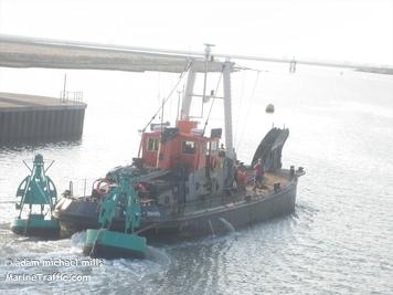
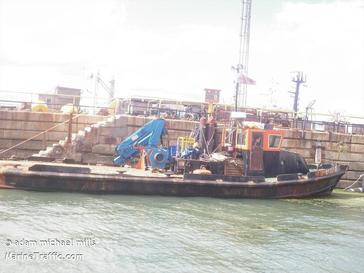
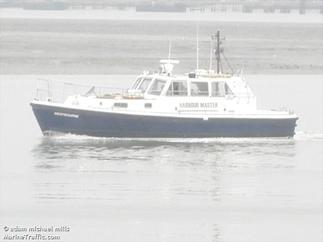
This website is 100% all my own work just a couple of the pictures come from Marine Traffic.com, but mostly all the pictures we're actually taken by me.
I gather all the shipping schedules from London Thamesport's website and The Svitzer VTS website.
If you have anything you want me to include on the website. email. adammichealmills@gmail.com
I gather all the shipping schedules from London Thamesport's website and The Svitzer VTS website.
If you have anything you want me to include on the website. email. adammichealmills@gmail.com
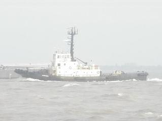
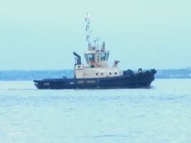
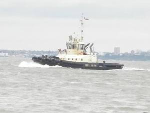
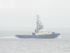
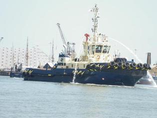
Medway Ports is the statutory harbour authority for a 27.3 mile stretch of the River Medway, from the Medway Buoy to Allington Lock.
River movements are monitored and controlled by Medway Ports’ Vessel Traffic Services (channel 74 "MEDWAY VTS") whose role is to facilitate the safety of all river users on the Medway from the largest container ships (Thamesport) and LNG vessels to leisure craft.
All vessels over 50m in length entering the River Medway need the services of a Medway Ports pilot, unless the Master holds a Pilotage Exemption Certificate.
Frequent hydrographic surveys of the Channels of the River Medway are carried out and these can be inspected or purchased from the Hydrographic Department.
Medway Ports Marine Services division are responsible for the maintenance and repair of navigational buoys in the Medway, including those which mark wrecks such as the SS Richard Montgomery.
The Marine Division produces a number of publications and forms, which are available to download from their website.